Immediately following the 3/11 disaster in Japan, South Korea was the first country to send in a rescue team and continued to send relief aid and resources to Japan over the course of the month. A reported $31.8 million was pledged as aid, but the good will between the neighboring countries was quickly soured as old disputes were once again brought to surface. Upon approval of natonal elementary school textbooks and publication of the Diplomatic Bluebook 2011 by the Ministry of Foreign Affairs – both of which asserted Japan’s claims over the controversial Takeshima / Dokdo Islands – South Korea put a damper on their generosity.
This incident, though appearing to be a petty fight over a petty 46 acres, is a continuation of a long-term dispute over the islands. This project aims to contextualize the most recent argument over the islands through a historical timeline and a cartographic study of the representation of the islands and respective claims of ownership. The localized intention of the project is to remain as close to objectivity as possible in the portrayal of this century-long dispute, and to leverage the point of conflict to call attention to the underlying tensions between Japan and Korea. On a broader scale, the project is also a comment on the practice of map-making and proposes an alternative form that embeds a history of ownership as opposed to merely the current status of possession.
The project will take the form of a series of hand-drawn maps and a historical timeline that corresponds with the maps and details, through time, the island dispute. The compilation of maps, which could loosely be interpreted as a “textbook” of maps – reflects the incident related to 3/11 as well as the inherent history through its pages. The maps are to be aggregated in reverse chronological order, with the most recent incident detailed first. As became evident through midreview, it may be difficult for all maps to be repurposed at a single scale; accordingly, the handful of scales will be chosen to depict the context of the islands as well as a detailed depiction of the islands. Ideally, the maps will span a number of years with varying frequency, and that frequency is to reflect the activity and escalation of disputes surrounding the islands. For example, perhaps five maps are necessary to accurately portray a period of conflict or war, whereas one is sufficient to portray a period of rest. In creating the maps, other layers of information may be crucial, such as the representation of movement of borders through military occupation, as well as the demographics of the islands and its inhabitants. The production of these maps, and the layering of information, are to adhere as cosely as possible to the graphic standards of map-making. The accompanying historical timeline will serve as a guide through the series of maps, and will contains descriptions of significant events regarding the claim to the islands as well as a parallel background that explains the political and legalistic implication of the respective events.
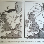
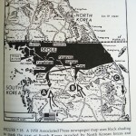
The following images are taken from How to Lie with Maps, authored by Mark Monmonie, and show a few examples of the kind of information portrayed in a map that is relevant to this project.

